Independence Day (July 4th) is one of the 10 National Holidays celebrated in the United States. This year, July 4th landed on a Tuesday. Luckily, work gave both Monday and Tuesday off which made it a 4-day weekend. I figured I should take one more day off to give me a solid 5 days - perfect for a road trip. 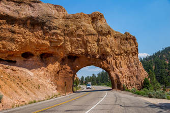
Originally we were thinking of doing a road trip up to either Yellowstone National Park or Glacier National Park, but the drive times cut into our time to actually explore the parks, and flight prices were out of control. After some more research, I stumbled upon Utah's Mighty5.
Utah's Office of Tourism has put together an entire itinerary for visitors to visit each of the 5 main National Parks within Utah. You can find it via visitutah.com. After reviewing the itinerary, it pretty much stated you would be spending an entire day at each Park. Since I had already gone to Zion back in December of 2016, I figured I'll skip that and go to the next. The 4 parks included:
Bryce Canyon National Park
I went with the prepared Itinerary, booked 3 nights at various lodges/hotels near each of the parks, and at 7:00AM on Friday we hit the road. We arrived at Bryce Canyon National Park around 2:00PM MDT, and went straight to all of the viewpoints: Paria View, Bryce Point and Inspiration Point. This helped us soak in the mesmerizing views of the hoodoo's while also stretch out our legs from sitting for so long. 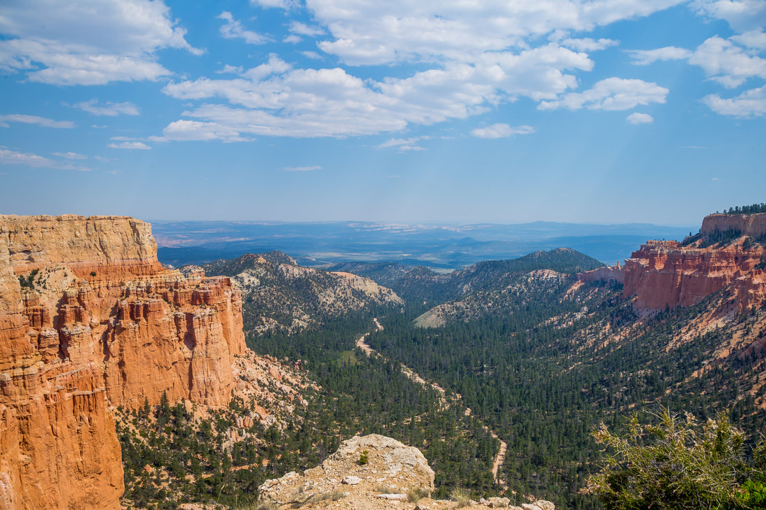
From there we went over to Sunrise Point and hiked part of the Navajo and Queens Loop trail which carved its way down in between the Hoodoo's. FYI: these hikes are partially sandy, so make sure you wear shoes that you don't mind ruining.
But wth are hoodoo's? Per the NPS site: Hoodoos are tall skinny spires of rock that protrude from the bottom of arid basins and "broken" lands. Nowhere in the world are they as abundant as in the northern section of Bryce Canyon National Park. At Bryce Canyon, hoodoos range in size from that of an average human to heights exceeding a 10-story building. Formed in sedimentary rock, hoodoo shapes are affected by the erosional patterns of alternating hard and softer rock layers. Thirty to 40 million years ago this rock was "born" in an ancient lake that covered much of Western Utah. Minerals deposited within different rock types cause hoodoos to have different colors throughout their height. 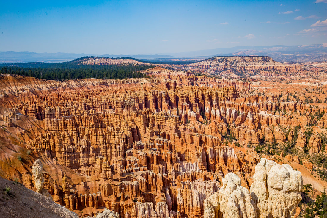
By 9:00PM we had done nearly everything at the park. Exhausted, we skipped the star gazing and head over to our lodge.
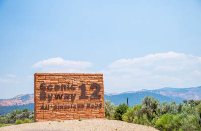
We woke early the next day and hit Highway 12 en route to Capitol Reef National Park. Technically you can take the Highway 22 to get to Capitol Reef, but trust me - take Highway 12. It's an 'America's Scenic Byway' Highway. It was the most beautiful drive I had ever driven in the United States. It's about a 2 and a half hour drive from Bryce to Capitol Reef, and every 10-15 minutes or so the landscape completely changes. From deep red rocks, yellow sanded canyons, grey sand dunes, to the lush cattle-grazing (yes, open grazing cattle!) Dixie forest, and vast open flower plains - the Highway 12 scenic drive is something to witness.
Capitol Reef National Park
It was about 11AM by the time we arrived at Capitol Reef National Park. Capitol Reef is one of those parks which don't have a entrance fee; you sort of just drive through it. First stop was Panorama Point and a view of the Mummy Cliffs. From there we continued on and checked out the petroglyphs carved on the side of the cliffs. The main hike is Hickman's Natural Bridge. Its a short .09 mile hike, and is a sort of preview to Arches National Park. We strapped my daughter to my chest and made our way the easy hike. There are some clear views of Capitol Dome while on on trail to Hickman's Natural Bridge as well. After completing the loop, we again hopped back in the car, make a quick stop to check out the Fruita Schoolhouse, then drove another 2 hours to Arches National Park.
Arches National Park
It was around 3PM when we arrived at Arches National Park - which gave us about 6 hours of sunlight time to explore the park. The entrance to the park is pretty unique: the entrance and pay/ranger station is at the foot of a tall cliff side. After paying, you start making your way back and forth up the cliff wall. Once at the top of the plateau, you turn the corner and the sights begin.
The 101 degree heat kept us selective of what we got out and really explored. We made quick stops at Park Avenue Trail head, La Sal Mountains Viewpoint, The Organ, Hole-in-the-Wall, and Petrified Dunes viewpoint. It wasn't until we got to Balance Rock where we really stretched our legs. After a couple snaps and walking half way around, we drove down The Windows Road. We got out to check out the Garden of Eden and its uniquely shaped pillars. From there we drover over to the Windows Trail. The hike to the North Window gave us an awesome view of the Turret Arch, a side view of Double Arch as well as some much appreciated shade. Next was the Double Arch hike. Double Arch is actually deceivingly large.
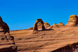
Again, due to the heat, we decided to opt out of the strenuous, 3 hour hike to the Delicate Arch. Instead, I figured the Lower and Upper Delicate Arch Viewpoint would suffice. Well, it didn't. All you see is a tiny arch far out in the distance. I had to use my 70-200mm lens to get a decent zoom of the Delicate Arch. If I ever have the pleasure of visiting, I'll have the Delicate Arch hike on the top of my list.
The Sand Dunes Arch was by far my favorite hike at Arches National Park. To start the hike you have to squeeze between 2 slabs of rock, wide enough for only one person. Also, the hike is almost entirely shaded (which was welcoming) except for if the sun was directly above you in the sky. The soft, peach-colored sand made it difficult to walk on, but the 0.3 mile hike was worth it. Probably the most unique hike at Arches that we did!
The last hike we went on was to the Landscape Arch via the Devil's Garden Trail head. In the park brochure the hike was described as 'relatively' flat.. but to be honest, not really. Still, an easy hike to a stunning view. The Landscape Arch is actually much larger in person; the width of the Arch seems to be the length of some midsize plane wings. Also, there are numerous cracks forming along either side and right along the middle. I'd recommend you come and see the arch before its gone.
In one day we went from Bryce Canyon National Park, to Capitol Reef National Park and Arches National Park! Enough sightseeing and time to unwind. We were staying in Moab, which is a friendly, hip town. A friend recommended we go to Arches Thai, the "best Thai food" he had ever had. Unfortunately it was closed, so we settled with some eh sushi at Sabaku Sushi. I would not recommend it. Overpriced basic rolls. 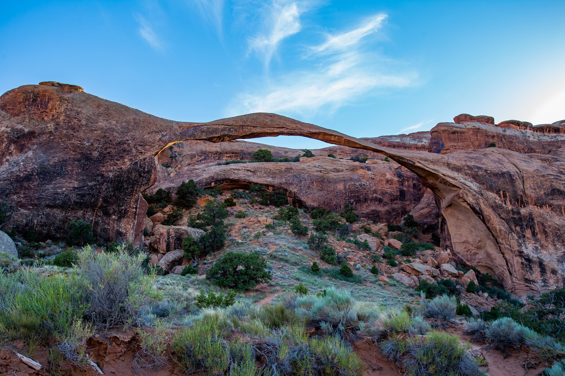
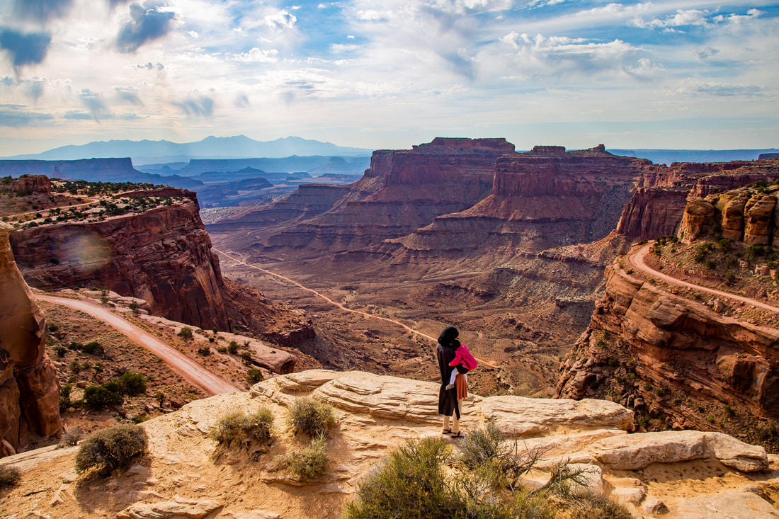
Canyonlands National Park Sunday morning, we woke up early again and drove 40 minutes to Canyonlands National Park. I've been to the Grand Canyon, and the best part of it was the first sight. After that, it sort of became the same thing over and over. So my wife and I figured a quick 2-3 hour visit should suffice. The first stop we made was at the Eye in the Sky visitor center which gave us a view of Shaffer Canyon (the picture below with my wife and daughter). Right off the bat you'll be able to tell this is an entirely different type of Canyon. The Grand Canyon is just one, massive canyon. Canyonlands is a collection of multiple canyons, and canyons within canyons within canyons within canyons. Truly breathtaking.
From Shaffer Canyon we made a quick stop to see the Candlestick Tower overlook, then went to Buck Canyon overlook. Each canyon overlook at its own charm and canyon experience. As you drive down Grand View Point Road, there are some places where on either side of the road are canyon cliffs, then the road opens up to large prairies. At the very end is the most majestic canyon view, the Grand View Point. From here you can see why the park is called Canyonlands. Multiple canyons feeding into each other as far out as the horizon goes. Jaw dropping.
Rather than spend another night, we figured it would be best to not prolong the inevitable: a 12 hour drive back home. Bryce Canyon National Park photos.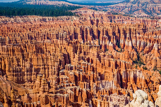
Capitol Reef National Park photos:![Zaki & Minaal - Capitol Reef National Park [2017]](https://farm5.staticflickr.com/4262/34909052983_8c785cd153_n.jpg)
Arches National Park photos.![Zaki & Minaal - Arches National Park [2017]](https://farm5.staticflickr.com/4119/34906032044_fa47b491d5_n.jpg)
Canyonlands National Park photos.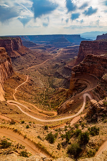
0 Comments
|
AuthorThis is the world through my lens. Categories
All
Archives
November 2017
|


 RSS Feed
